


")


Project Overview
The overarching goal for the Maryland Parkway corridor is to spur transit-oriented development (TOD) in the Las Vegas Valley after years of study. The TOD Plan will evaluate the development around station areas along the corridor, designed for bus rapid transit (BRT), but flexible enough to evolve to any other mode of high-capacity transit. The RTC, along with the City of Las Vegas and Clark County will conduct the plan to help deliver equitable TOD along Maryland Parkway, and provide a model for the region.
The TOD Plan will locate priority station areas along Maryland Parkway and ensure that the nearby development will build upon existing economic, physical, and social assets to create community amenities unique to the Las Vegas Valley. The plan will create a roadmap for stitching together existing and new destinations and improving the corridor with great streets, exciting public spaces, public art, and a vibrant mix of uses.
Definitions
- Transit-Oriented Development (TOD) is a type of development located close to high quality, high capacity transit, that creates a compact, walkable, mixed-use and dense environment. TOD areas contribute to livable communities and serve as activity centers that provide a range of benefits to the region, local community, and individual households.
- A station area consists of the area surrounding a transit station. The highest intensity of uses and most dense developments are typically located closest to the station itself, where transit access adds the most value.
- Bus Rapid Transit (BRT) is a high-quality bus service that operates much like light rail, providing frequent, rapid service in dedicated transit lanes.
Benefits of TOD

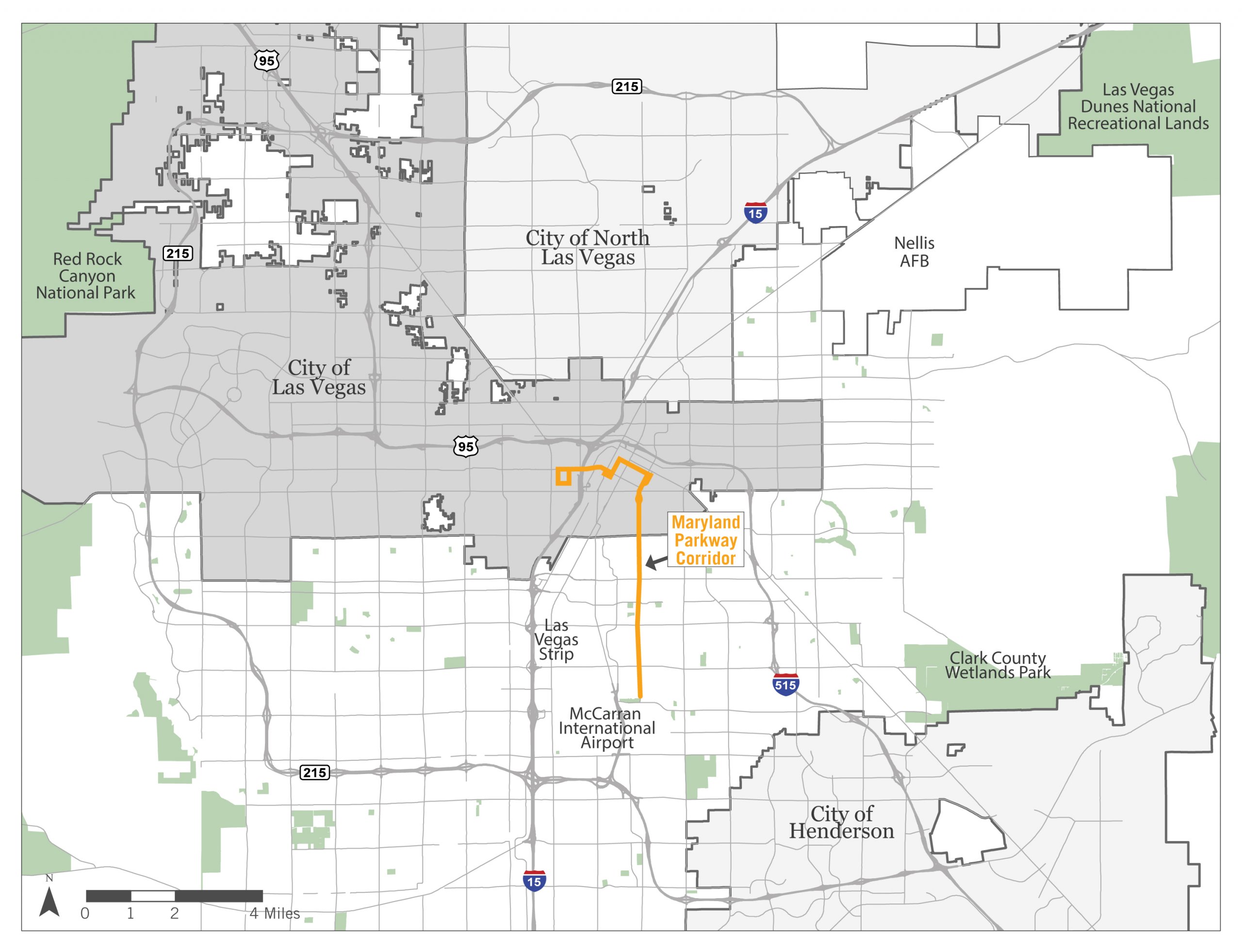
Locator Map

Project Process and Timeline

Existing Conditions and Needs Assessment – Task 1 will include an inventory of all existing and planned transportation components, land uses, infrastructure, and economic development opportunities along the corridor in order to identify locations with high potential for development and placemaking.
Market Analysis of Districts and Stops – Task 2 will involve developing a custom, market-based, Transit Oriented Development/Economic Development matrix for which station areas have the most potential for development success.
Workforce Housing Plan – Task 3 will focus on finding opportunities for TOD along Maryland Parkway to provide equitable access to affordable and attainable housing. This is a critical piece of helping the Maryland Parkway corridor build a resilient future through transit investment.
Station Area TOD Plans – Task 4 aims to ensure that the Maryland Parkway Corridor and each individual station have their own distinct identity, as well as identify strategies to prevent displacement of existing residents, businesses, and community institutions in each station area.
Value Capture Toolkit – Task 5 will develop a value capture toolkit that indicates the cost recovery and value that TOD and transit helps create and identify current and potential funding and incentive mechanisms.
Performance Measures Template – Task 6 will create a strong system, including a public-facing dashboard to track progress toward implementation of the visions of the Maryland Parkway Station Area TOD Plans. This will enable continued refinement of the implementation process based upon lessons learned over time.
Meetings
Missed the last meeting? Download the presentation PDF
Resources
Maryland Parkway TOD
Transit-Oriented Development (TOD) is a type of development located close to high quality, high capacity transit, that creates a compact, walkable, mixed-use and dense environment. One of the goals of the Maryland Parkway project is to spur transit-oriented development (TOD) in the Las Vegas Valley. The TOD Plan will evaluate the development around the new transit shelters along the corridor. You can learn more about TOD here.
- Maryland Parkway TOD Project Fact Sheet
- Community Engagement Window #1: Feedback Memo (January 27 – 29, 2020)
- Community Survey Report, July 2020
- 2020-2021 Fall_Winter Survey Report
Maryland Parkway Corridor TOD Plans Executive Summary
- Maryland Parkway Corridor Transit Oriented Development (TOD) Plans (Digital)
- Maryland Parkway Corridor Transit Oriented Development TOD Plans (Print)
- Corredor De Maryland Parkway Desarrollo Orientado Al Tránsito Público (Digital) (Spanish language)
Consultant Team
