Stationary Sensor Pilot
As part of the Urban Heat Mapping Mapping Campaign, our region was one of two locations selected to take part in a stationary sensor pilot to capture temperature and humidity data over time. Adding stationary sensors to the campaign allowed for a longitudinal look at how spatial patterns of heat vary over time under varying weather conditions.
Click here to download the stationary sensor data logs.
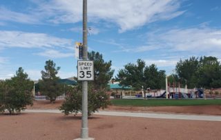
Photos of several of the stationary sensors across the community. Click on an image to enlarge.
About
Several weeks prior to the Urban Heat Mapping Campaign, project organizers installed 10 Onset HOBO MX2302A sensors in targeted locations across the county's urbanized area. The sensors, placed 12-15 feet off the ground, recorded temperature and humidity measurements every fifteen minutes continuously from early August to late November, including on the day of the Heat Watch campaign. In total, more than 120,000 measures were taken.
Click here to download the stationary sensor data logs (.csv)
Spread across a diverse range of land uses and land covers, the sensors provide a robust temporal dataset to match with the rich spatial information that volunteer teams collected through the mobile Urban Heat Mapping Campaign. See pages 20-22 of the Urban Heat Mapping Campaign summary report for additional details on and data from stationary sensor campaign.
Sensor locations
The locations of the stationary sensors are mapped below. The sensors were distributed across the diverse geography of the region, and located at a range of land use and land cover types, such as near parking lots, parks, busy roadways, and vacant land. With only 10 sensors to cover the 430-square-mile study area, project organizers had to strike a balance between evenly distributing them across the region and placing them in neighborhoods where environmental justice concerns are high. All sensors were mounted on or with existing RTC transit amenities.
Click here for interactive full screen map.


